Where Growth Is Being Built
100 New Zealand Growth Suburbs: Housing, Infrastructure, Road Works and Traffic Management Hotspots
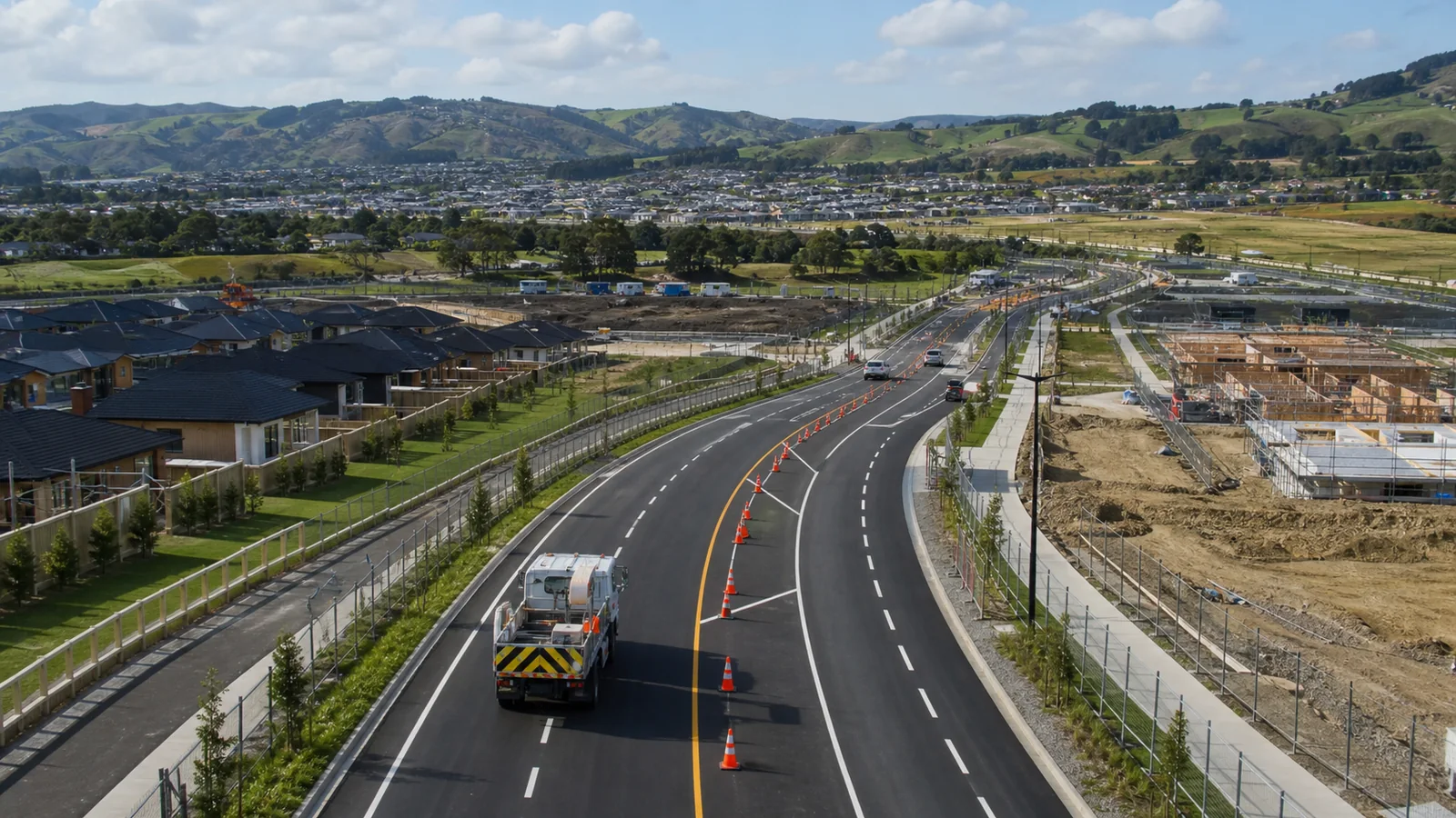
New Zealand's next growth suburbs are being shaped by more than property prices. The strongest signals now come from infrastructure investment, housing supply, transport upgrades, council planning, industrial growth and construction activity. These are also the suburbs where traffic management, TMP planning, road works coordination and construction access will matter most.
From Drury’s rail-and-retail reset to Tauriko West’s greenfield expansion, Queenstown’s fast-tracked housing corridors and Lower Hutt’s RiverLink works, New Zealand’s next property story is being shaped less by price charts and more by roads, pipes, bridges, rail stations, district plans, construction access and traffic management.
Related traffic management support
For projects in growth areas like these, TM Matters can help with TMP design and submission, construction access and site traffic management, traffic management plans, temporary traffic management and early project advice.
The New Growth Map
The suburb to watch is not always the one with the sharpest house-price rise. Increasingly, it is the place where a new station is being built, a road corridor is being upgraded, a district plan has changed, a council has funded pipes, or a large development has moved from concept to consent.
That is the shift now reshaping New Zealand’s property conversation. The old way of identifying “growth suburbs” was simple: look at recent sales, find where prices had jumped fastest, and assume the trend would continue. But in a more expensive, more cautious and more infrastructure-constrained market, price momentum alone is a weak foundation.
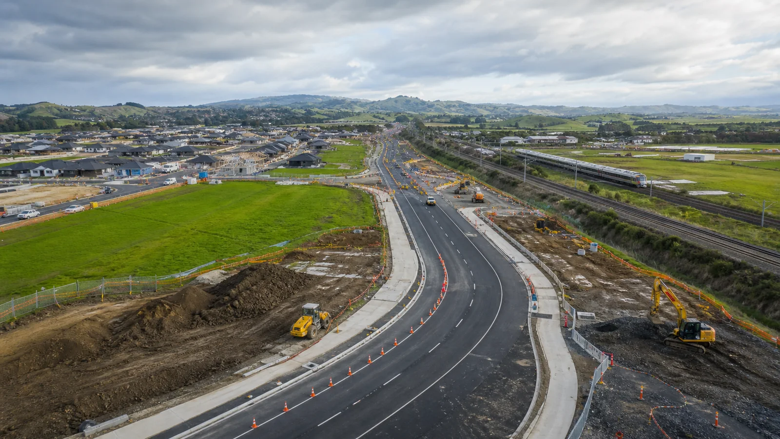
The stronger signal is physical. It is a widened state highway. A new bridge. A stormwater upgrade. A wastewater network. A new interchange. A fast-tracked subdivision. A hospital precinct. A port expansion. A town-centre renewal programme. These are the changes that alter how a suburb functions, how many people it can support, where jobs are created, and whether private development can follow.
They also create a second, less visible growth story: traffic management.
Every new subdivision, utility trench, bridge, rail station, transport corridor, town-centre upgrade and industrial estate eventually has to be built on or near live roads. That means construction traffic, temporary speed limits, lane closures, pedestrian diversions, bus stop relocations, driveway access, truck routes, worksite access points, temporary traffic management plans, public notifications and staging methods.
In other words, growth suburbs are not just property suburbs. They are future worksite corridors.
This feature looks at 100 suburbs, towns, growth corridors and local areas across New Zealand where real-world growth drivers are visible. The list is not based on median values alone. It is based on infrastructure, housing supply, transport connectivity, planning support, population demand, commercial activity, public works and evidence strength.
At the top of the watchlist are places where multiple signals overlap. Drury stands out because rail, motorway upgrades, town-centre development and greenfield housing are arriving in the same corridor. Tauriko West is one of Tauranga’s most important future housing areas, tied closely to SH29 transport improvements. Peacocke is Hamilton’s southern growth front, where bridges, roads and three-waters infrastructure are preparing land for new neighbourhoods. In Queenstown-Lakes, Homestead Bay and Te Pūtahi Ladies Mile show how housing pressure is being converted into large-scale planning and consent decisions.
But this is not just an Auckland, Tauranga or Queenstown story. It is also a Lower Hutt story, where RiverLink combines flood protection with transport and urban renewal. It is a Northcote, Māngere, Tāmaki and Mt Roskill story, where older public housing land is being redeveloped into denser mixed-tenure neighbourhoods. It is a Rolleston and Rangiora story, where Canterbury’s commuter belt continues to grow around roads, services, industrial land and population demand.
The next suburb story will not be found by chasing hype. It will be found by reading infrastructure budgets, transport maps, construction programmes, council plans and the places where public and private capital are finally meeting on the ground.
“The clearest growth signal is not a price graph. It is a funded pipe, a consented road, a new station, a live worksite or an operative plan change.”
Why Growth Suburbs Are Also Traffic Management Corridors
Growth does not arrive quietly. It comes with diggers, trenching crews, concrete trucks, surveyors, delivery vehicles, temporary fencing, worksite access gates, construction parking, road cones, truck crossings, footpath closures, temporary pedestrian routes and staged traffic control.
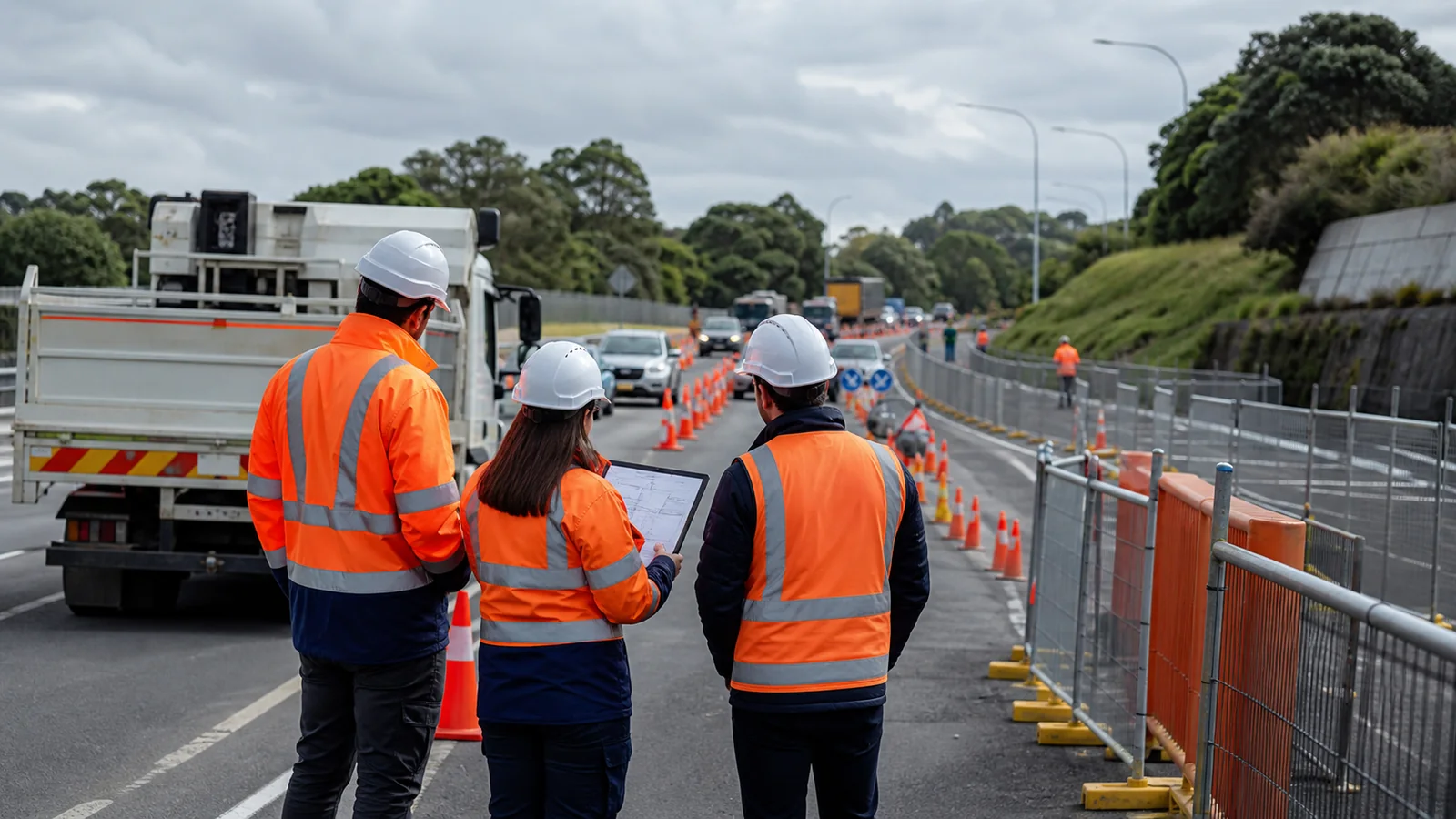
This is why traffic management belongs in the growth-suburb conversation. A property article may focus on homes, values, subdivisions and population. A council plan may focus on zoning, stormwater and transport capacity. A developer may focus on lots, yield and sales. But before any of that becomes reality, the work must be delivered safely through live streets.
That requires traffic management planning.
A greenfield subdivision may need safe construction access from an existing rural road. A town-centre redevelopment may need pedestrian access maintained around shops. A water-main upgrade may need lane closures and driveway coordination. A state highway project may require temporary speed limits and night works. A bus stop may need temporary relocation. A school frontage may need special controls during pickup and drop-off. A hospital or emergency-services route may require extra protection from queuing and delays.
In New Zealand, this is especially important because growth is often happening around constrained corridors: SH1 south of Auckland, SH29 in Tauranga, SH6 in Queenstown-Lakes, the Melling interchange in Lower Hutt, commuter roads in Selwyn and Waimakariri, and older urban roads in Auckland regeneration suburbs.
For councils, civil contractors and developers, traffic management is not an afterthought. It is part of whether the project can be delivered with acceptable risk to residents, workers, pedestrians, cyclists, buses, emergency vehicles and local businesses.
That is why this article uses a practical lens. It asks not only “Where is growth happening?” but also “Where will the road works, utility works, construction access and temporary traffic management pressure increase?”
The answer is clear: the suburbs on this list are not just property watchlist areas. They are infrastructure delivery zones.
What Traffic Management Means in Growth Suburbs
Traffic management in growth areas can include:
- Temporary traffic management plans for road works
- Site access planning for subdivisions and civil works
- Temporary speed limits around construction zones
- Lane closures, shoulder closures and stop/go operations
- Pedestrian and cyclist diversion routes
- Bus stop relocation and public transport coordination
- Truck crossing management
- Worksite access and egress control
- Resident and business access planning
- Emergency access protection
- Utility works staging for water, wastewater, power and fibre
- Construction traffic routing through existing neighbourhoods
How We Ranked the 100 Suburbs

This watchlist uses a simple principle: growth should be measured by what is being built, enabled or funded — not only what buyers paid last month.
Each suburb or local area was assessed against seven criteria.
Infrastructure investment carried the heaviest weight: roads, rail, busways, bridges, stations, water networks, flood protection, hospitals, schools, ports, airports and civic works. Housing and land development was also critical, including subdivisions, apartments, master-planned communities, Kāinga Ora projects, private developments and intensification.
The analysis also considered population and demand growth, planning and rezoning support, commercial and employment growth, transport connectivity and evidence strength. Areas with funded, consented, under-construction or officially approved projects scored more strongly than suburbs relying on early concepts or speculative announcements.
That distinction matters. New Zealand has no shortage of plans. Many councils have future development strategies, spatial plans, structure plans and long-term infrastructure programmes. Some identify thousands of future homes. But not all planned land becomes buildable land quickly. A suburb may be zoned for growth, yet still be held back by wastewater capacity, stormwater design, funding gaps, appeals, fragmented ownership, development contributions or roading constraints.
That is why the strongest areas in this list are those with several reinforcing factors.
Drury has transport and town-centre approval. Tauriko West has housing scale and enabling transport work. Peacocke has core infrastructure largely delivered. Homestead Bay has fast-track approval. Ladies Mile has operative rezoning. Melling has a major flood-and-transport programme. Ruakura has logistics employment and residential growth. Northcote has public-sector regeneration and town-centre renewal.
For traffic management and civil delivery, these areas are also important because the work is not isolated. Where large-scale development occurs, road works tend to follow. Where pipes are upgraded, carriageways are affected. Where new communities are created, intersections, walking routes, cycling links, bus stops and construction access points all need to be planned.
Scoring method
- Infrastructure investment: 20 points
- Housing and land development: 20 points
- Population and demand growth: 15 points
- Planning and rezoning support: 15 points
- Commercial and employment growth: 10 points
- Transport connectivity: 10 points
- Evidence strength: 10 points
Method note
Suburbs were not included only because house prices had risen. Each area needed a real-world growth driver such as infrastructure, transport, housing supply, rezoning, regeneration, employment land, public investment, major private development or public-works delivery.
Auckland, Waikato and Bay of Plenty
Auckland’s growth is increasingly corridor-based. The most powerful signals are not evenly spread across the city; they cluster where transport, land supply and planning decisions align.
In the south, Drury is the most complete example. It is no longer simply “future urban land” on a map. It is becoming a new metropolitan centre, supported by fast-track approval for Drury Metro Centre, major SH1 works, new rail stations and local road upgrades. Papakura, Ngākōroa / Drury West, Paerātā and Pukekohe all sit within the same southern transport reset, where rail electrification and motorway investment are changing the accessibility of Auckland’s southern edge.
From a traffic management perspective, this corridor will remain highly active. Rail station works, state highway upgrades, local road improvements, subdivision access and construction traffic will all require careful temporary traffic management as development moves from planning into delivery.
Nearby, Sunfield at Ardmore–Takanini is one of the country’s boldest new master-planned community approvals. With thousands of homes, a town centre, healthcare, retirement living, open space and business land, it reflects a new expectation for large developments: housing alone is not enough. A growth area now needs jobs, services, public spaces and transport logic.
In the north, Milldale continues to show the strength of infrastructure-backed subdivision. Whangaparāoa’s growth story is tied to Penlink, a long-awaited connection between the peninsula and SH1. Warkworth South, Ōrewa / Delmore, Riverhead and Westgate / Red Hills show the continued pressure on Auckland’s northern and northwestern edges, although sequencing and infrastructure funding remain critical risks.
Inside Auckland’s established urban area, regeneration is the stronger theme. Northcote is being rebuilt around new homes, town-centre renewal, parks, greenways and improved streets. Māngere, Tāmaki and Mt Roskill are part of longer-term Kāinga Ora renewal programmes, replacing older public housing with warmer, denser mixed-tenure neighbourhoods.
Hamilton and Waikato add another dimension: logistics. Peacocke is the planned housing story, with public infrastructure unlocking Hamilton’s southern edge. Rotokauri is the next infrastructure-heavy growth front. Ruakura combines the inland port, the Superhub, industrial land and new housing — making it one of the few areas where employment and residential demand are growing side by side.
Further east, Tauranga’s pressure is split between west and east. Tauriko West is the major western housing front, with thousands of homes planned and transport-enabling works tied to SH29. Tauriko Business Estate and The Lakes add employment and established urban structure. To the east, Te Tumu and Wairakei South point to the next stage of Pāpāmoa’s expansion, although coastal resilience, infrastructure funding and transport capacity will shape how quickly those areas move from planning to delivery.
Case study: Drury
Drury is the clearest example of infrastructure-led growth in New Zealand. It combines rail, motorway upgrades, local road improvements, town-centre approval and greenfield land supply. That does not make it risk-free. The build-out will take years, and early residents may live with construction, traffic changes and incomplete amenities. But as a long-term urban growth story, Drury has the rare combination of transport, planning, private capital and public investment.
Traffic management angle
Drury is also one of the strongest future traffic management hotspots. Major works around rail stations, SH1, SH22, Waihoehoe Road, subdivision access, construction vehicle routes and local intersections will require staged TMP planning over many years.
Wellington and Canterbury
Wellington’s growth story is very different from Auckland’s. The region does not have endless flat land at its edge. Hills, harbour, seismic risk, old infrastructure and flood exposure all shape where growth can realistically happen.
That makes regeneration and resilience central to the watchlist.
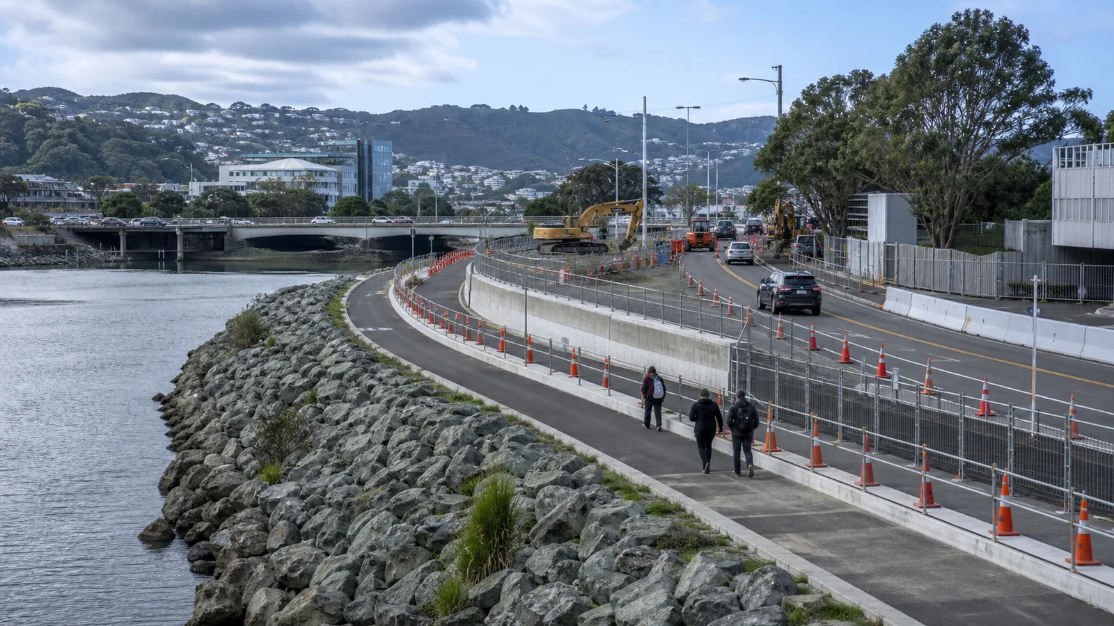
Melling / Lower Hutt is one of the clearest examples. RiverLink is not just a transport project, and it is not just a flood project. It combines flood protection, a new bridge, a grade-separated SH2 interchange, a relocated rail station, walking and cycling links and urban renewal around the Lower Hutt city centre. That mix gives Melling a rare three-part growth signal: resilience, connectivity and regeneration.
It also creates one of the most complex traffic management environments in the country. Bridge works, interchange construction, station relocation, local road changes, pedestrian access, cycling routes, river works and city-centre access all need to be staged while residents, commuters and businesses keep moving.
Eastern Porirua is another major Wellington-region story, but for different reasons. Te Rā Nui is a long-term public-housing regeneration programme across areas such as Cannons Creek and Waitangirua. It is not a quick private subdivision; it is a generational renewal project involving homes, infrastructure, community outcomes, jobs and local business opportunities. For traffic management, regeneration areas often create repeated small-to-medium worksites across several streets rather than one single large project.
Wellington City itself has more selective opportunities. Johnsonville and Karori have town-centre redevelopment signals. Te Ngākau and the civic precinct reflect public-realm and central-city regeneration. Newtown and Kilbirnie remain logical intensification corridors under compact-city planning, although water, seismic and transport constraints matter.
Across the Cook Strait, Canterbury is a different model again. Rolleston remains the benchmark South Island growth town. Its strength is not one single project, but the alignment of population growth, family housing, transport access, industrial land, council infrastructure and proximity to Christchurch. Selwyn’s wider commuter belt — including Lincoln, Prebbleton and West Melton — continues to attract households seeking space, new builds and regional accessibility.
Waimakariri adds the northern growth layer. Rangiora and Kaiapoi are not simply Christchurch dormitory towns anymore. Rangiora has its own retail, services and subdivision momentum, while Kaiapoi continues its long-term recovery and growth pattern. Woodend and Pegasus remain part of the wider North Canterbury lifestyle-and-commuter belt.
Christchurch itself is also back in the growth conversation. Halswell, Wigram, Belfast, Prestons, Riccarton, Hornby, Papanui, Sydenham South and Richmond all appear because of intensification, town-centre potential or planning signals. Harewood / Ryans Road stands apart as an industrial story, with airport-edge employment land showing how jobs can drive housing demand nearby.
Case study: Melling / RiverLink
Melling shows why resilience infrastructure can become growth infrastructure. Flood protection is not just defensive. When paired with transport upgrades and city-centre renewal, it can change how a suburb is perceived, what land can support, and how confidently private development may follow.
Traffic management angle
Melling and Lower Hutt CBD will require long-term temporary traffic management around SH2 access, local road staging, pedestrian routes, cycling links, rail station relocation, truck movements and public access to the city centre.
Regional Growth Hotspots
Outside the main metros, the strongest growth signals are more specialised. Some are driven by tourism, some by logistics, some by hospitals and civic projects, and some by council plan changes that unlock new housing supply.
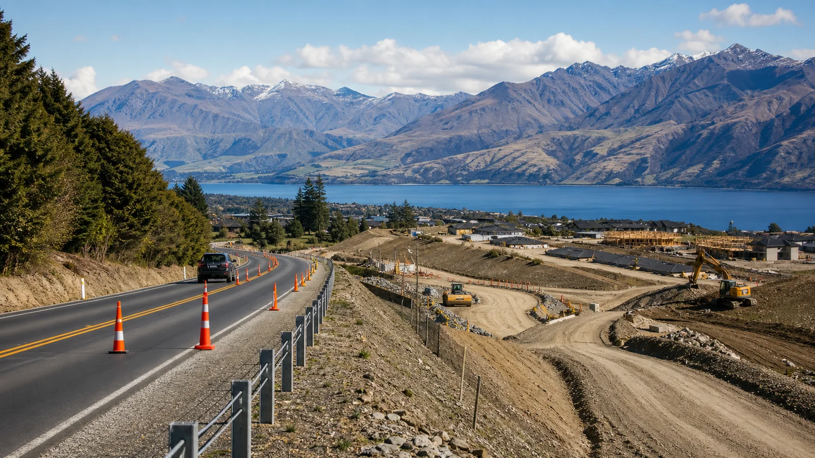
Queenstown-Lakes remains the most intense regional market. Homestead Bay is a major fast-tracked housing project near Lake Wakatipu, with approval for thousands of residential allotments and a commercial precinct. Te Pūtahi Ladies Mile is a planning-led story, with operative zoning enabling higher-density residential development. Lakeview is Queenstown’s central mixed-use intensification play, while Frankton remains the district’s practical commercial and transport hub. Wānaka South, the Wānaka CBD–Three Parks corridor and Lake Hāwea / Longview all reflect the same broader issue: growth demand is intense, but infrastructure, affordability and traffic remain major constraints.
Dunedin’s strongest signal is the hospital precinct. A major hospital build changes worker flows, health-sector employment, nearby commercial activity and demand for accommodation. South Dunedin is different: its watchlist status is driven by climate adaptation and flood resilience, showing that future growth analysis must now include risk management, not just expansion.
Nelson-Tasman is led by Richmond South-West and Plan Change 81, which supports new housing and business land across places such as Richmond, Motueka, Brightwater, Wakefield and Tākaka. This is not a speculative price story; it is a zoning and infrastructure story in a region where land supply and water servicing matter.
Hawke’s Bay offers both edge development and regeneration. Arataki, on the Havelock North edge, brings new residential capacity into a tight market. Flaxmere, by contrast, is about affordability and council-backed housing renewal, including mixed-tenure and senior housing initiatives.
Taranaki’s watchlist areas include Bell Block and New Plymouth’s southern edge / Smart Road, both tied to future urban planning and housing capacity. Manawatū’s signal is logistics: Palmerston North’s North East Industrial Zone, airport/Milson area and Te Utanganui freight strategy reinforce its role as a lower North Island distribution hub. Levin / Tara-Ika gives Horowhenua a major master-planned housing area on a regional transport corridor.
Northland’s strongest signal sits around Marsden Point / Ruakākā, where port expansion consent and structure planning support a port-led growth narrative. Whangārei City Centre, Kamo / Tikipunga and One Tree Point / Marsden Cove all sit within that wider story of housing, revitalisation and freight-linked development.
Case study: Homestead Bay and Ladies Mile
Queenstown-Lakes shows the tension between scenic amenity and urban necessity. Homestead Bay adds scale through fast-track approval. Ladies Mile adds planning capacity through operative rezoning. Together, they show a district being forced to convert housing pressure into planned supply, even as infrastructure and affordability questions remain unresolved.
Traffic management angle
Queenstown-Lakes growth areas will need careful traffic management because many works rely on constrained roads, tourism traffic, limited alternative routes, worker access, construction deliveries and staged subdivision entry points.
Traffic Management: The Hidden Layer Behind the Top 100
Every location in the Top 100 watchlist has a visible growth story: housing, transport, infrastructure, regeneration, industrial land, town-centre renewal or public investment. But behind nearly all of them sits another practical requirement — traffic management.
As suburbs such as Drury, Tauriko West, Peacocke, Melling, Rolleston, Northcote, Māngere, Tāmaki, Ruakura, Homestead Bay and Ladies Mile move from planning to construction, the pressure on local roads will increase. That pressure is not only about traffic volumes. It is about how works are staged, how residents access homes, how buses move, how pedestrians are protected, how cyclists are redirected, how emergency routes remain open and how heavy construction traffic enters and exits work areas.
This is especially important for growth areas with schools, town centres, hospitals, public transport, elderly residents, commercial frontages or narrow existing roads. A badly staged project can create congestion, safety risks, business disruption and community frustration. A well-planned traffic management strategy can reduce conflict, protect vulnerable road users and help contractors deliver works efficiently.
For developers and civil contractors, traffic management planning should start early. It should not be left until the week before construction. Growth areas often need consultation with councils, road controlling authorities, public transport operators, emergency services, nearby businesses, residents and utility providers.
The best TMPs do more than place cones on a road. They explain the work method, staging, hours, road-user impacts, property access, pedestrian routes, cycle routes, bus impacts, temporary speed limits, signs, barriers, detours and emergency arrangements.
That is why the Top 100 list below includes a traffic management and worksite relevance column. It shows how each growth area may create future demand for temporary traffic management, road works planning, construction access control and civil works coordination.
“Growth is not only about what gets built. It is also about how safely the work is delivered while the community keeps moving.”
Full Top 100 Watchlist: Growth and Traffic Management Relevance

| Rank | Location | Region | Main Growth Signal | Traffic Management / Worksite Relevance |
|---|---|---|---|---|
| 1 | Drury / Drury Centre | Auckland | Rail, motorway, town centre and greenfield urbanisation | Major traffic management demand around SH1 works, rail stations, local road upgrades, subdivision access and construction traffic. |
| 2 | Tauriko West | Tauranga / Bay of Plenty | Large greenfield housing plus SH29 corridor works | Temporary traffic management likely around SH29 enabling works, subdivision access, utility upgrades and staged road construction. |
| 3 | Peacocke | Hamilton / Waikato | Council-led infrastructure for a new southern community | TMP planning required for new roads, bridges, utilities, intersections, construction traffic and residential staging. |
| 4 | Homestead Bay | Queenstown-Lakes | Fast-tracked master-planned housing | Traffic management needed for subdivision access, construction vehicle movements, constrained rural roads and visitor-region traffic. |
| 5 | Te Pūtahi Ladies Mile | Queenstown-Lakes | Operative rezoning for dense housing | Traffic management will be critical around SH6, local access, pedestrian routes, cycling links and staged construction. |
| 6 | Ardmore–Takanini / Sunfield | Auckland | Fast-tracked master-planned community | Strong future TMP demand for new roads, town-centre works, construction access, truck routes and surrounding local roads. |
| 7 | Ruakura / Greenhill | Hamilton / Waikato | Inland port, logistics and housing | Traffic management needed for freight access, industrial sites, intersection upgrades, heavy vehicle routes and housing works. |
| 8 | Rotokauri | Hamilton / Waikato | Stormwater, roads and future urban infrastructure | Worksite traffic management required for drainage corridors, road upgrades, utilities and greenfield staging. |
| 9 | Milldale / Wainui | Auckland | Large subdivision and infrastructure funding | Subdivision traffic management, construction access, utility works, local road tie-ins and pedestrian management. |
| 10 | Northcote | Auckland | Kāinga Ora regeneration and town-centre renewal | Repeated traffic management around housing rebuilds, town-centre works, pedestrian access and local road upgrades. |
| 11 | Melling / Lower Hutt CBD | Wellington Region | Flood resilience, rail, bridge and interchange works | Complex temporary traffic management around SH2, bridge works, station relocation, local roads and city-centre access. |
| 12 | Eastern Porirua / Cannons Creek / Waitangirua | Porirua / Wellington Region | Large-scale public housing regeneration | Neighbourhood traffic management for staged housing works, utilities, school routes, pedestrians and residential access. |
| 13 | Wairakei South / Bell Road | Pāpāmoa / Tauranga | Fast-track growth area | Future TMP demand for eastern growth-area roads, industrial access, utilities and subdivision works. |
| 14 | Ōmokoroa | Western Bay of Plenty | Road widening and state highway corridor | Traffic management around road widening, shared paths, water mains, SH2 links and residential construction. |
| 15 | Te Tumu / Pāpāmoa East | Tauranga | Long-term urban growth area | Traffic management for coastal growth, construction access, transport links, stormwater works and future community facilities. |
| 16 | Arataki / Havelock North edge | Hastings / Hawke’s Bay | Fast-tracked residential land | Local traffic management for subdivision access, residential works, pedestrian routes and servicing upgrades. |
| 17 | West Flaxmere / Flaxmere | Hastings / Hawke’s Bay | Council housing and mixed-tenure renewal | TMP planning for housing delivery, local streets, footpath access and community facilities. |
| 18 | Lakeview / Queenstown town centre | Queenstown-Lakes | Urban mixed-use redevelopment | High-sensitivity traffic management near town centre, visitor traffic, pedestrians, parking and construction deliveries. |
| 19 | Harewood / Ryans Road | Christchurch | Industrial fast-track approval | Heavy vehicle traffic management for airport-edge industrial works, truck access and local road interfaces. |
| 20 | Rolleston | Selwyn / Canterbury | Population growth and infrastructure spend | Traffic management demand from subdivisions, industrial access, road upgrades, school routes and commuter pressure. |
| 21 | Rangiora / West Rangiora | Waimakariri / Canterbury | Subdivision growth and transport planning | TMP planning for residential expansion, road connections, water works and future eastern link works. |
| 22 | Tāmaki: Glen Innes, Panmure, Point England | Auckland | Public-sector regeneration | Ongoing traffic management for housing replacement, utilities, town-centre works, bus routes and pedestrian access. |
| 23 | Māngere | Auckland | Kāinga Ora large-scale housing renewal | Traffic management for staged redevelopment, airport corridor access, construction traffic and local streets. |
| 24 | Mt Roskill / Ōwairaka / Waikōwhai | Auckland | Large-scale redevelopment | TMP requirements for housing intensification, infrastructure upgrades, walking links, parks and residential access. |
| 25 | Levin / Tara-Ika | Horowhenua / Manawatū-Whanganui | Master-planned growth cell | Traffic management for new roads, subdivision staging, construction access and future school/community facilities. |
| 26 | Warkworth South / Waimanawa | Auckland | New township and link road | Road works traffic management for link roads, subdivision access, utilities and local retail construction. |
| 27 | Oranga | Auckland | Kāinga Ora neighbourhood redevelopment | Localised TMPs for housing renewal, demolition, new builds, footpath controls and resident access. |
| 28 | Mission Bay / The Point | Auckland | Fast-tracked retirement and residential development | Urban traffic management for construction deliveries, pedestrian access, parking pressure and local roads. |
| 29 | Whangaparāoa / Stanmore Bay | Auckland | Penlink transport connection | Traffic management around Penlink works, peninsula access, intersections and future development pressure. |
| 30 | Ōrewa / Delmore | Auckland | Fast-track housing proposal and interchange works | TMP planning for future subdivision access, interchange works, local traffic and coastal growth pressure. |
| 31 | Riverhead / Rangitōpuni | Auckland | Residential and retirement approval | Traffic management for rural-edge subdivision access, local road upgrades and construction traffic. |
| 32 | Westgate / Red Hills | Auckland | Northwest priority growth area | Road works and traffic management around town-centre growth, housing, utilities and congested corridors. |
| 33 | Frankton / Te Kirikiri | Queenstown-Lakes | Structure planning for major density | High traffic management sensitivity due to airport, SH6, retail, tourists, commuters and construction access. |
| 34 | Marsden Point / Ruakākā | Whangārei / Northland | Port expansion and structure planning | Traffic management for port-related freight, industrial access, housing growth and state highway links. |
| 35 | Papakura | Auckland | Southern rail and motorway works | TMP planning around SH1, rail works, local roads, bus connections and town-centre intensification. |
| 36 | Ngākōroa / Drury West | Auckland | New rail station and SH22 widening | Traffic management for station access, SH22 upgrades, bridge/road works and future housing delivery. |
| 37 | Paerātā | Auckland | Rail electrification and new station | Construction traffic management around station works, rail access, local roads and new housing areas. |
| 38 | Pukekohe | Auckland | Electrified rail and southern growth | TMP demand around rail upgrades, local road changes, housing intensification and town-centre access. |
| 39 | Horotiu / Te Awa Lakes | Waikato | Infrastructure financing for housing | Traffic management for riverside development, water/road works and construction access near key corridors. |
| 40 | Palmerston North NEIZ / Te Utanganui | Manawatū | Logistics and freight hub | Heavy vehicle traffic management for industrial works, freight routes, rail/road access and distribution centres. |
| 41 | Te Kauwhata / Lakeside | Waikato District | Master-planned lakeside housing | Subdivision traffic management for local access, utility works, construction routes and residential staging. |
| 42 | Cambridge | Waipā / Waikato | Population growth and infrastructure planning | TMP planning for growth-area roads, utilities, town-centre works and residential expansion. |
| 43 | Matamata / Ashbourne | Waikato | Fast-track large housing proposal | Traffic management for staged housing, retirement units, neighbourhood centre works and local road access. |
| 44 | Hamilton Central | Hamilton | Central-city investment and intensification | Urban traffic management for streetscape works, services, construction deliveries and pedestrian routes. |
| 45 | Tauranga CBD / Te Manawataki | Tauranga | Civic and waterfront redevelopment | High-profile traffic management around civic works, waterfront access, pedestrians, parking and local businesses. |
| 46 | Tauriko Business Estate / The Lakes | Tauranga | Employment land and western corridor | Traffic management for industrial access, SH29 corridor works, truck routes and local intersections. |
| 47 | Dunedin hospital precinct / central Dunedin | Dunedin / Otago | New hospital construction | Major traffic management around hospital works, public transport, pedestrian routes, deliveries and emergency access. |
| 48 | Wānaka South | Queenstown-Lakes | Structure planning for major future housing | Traffic management planning needed for SH access, subdivision staging, local roads and construction pressure. |
| 49 | Pyes Pā / Keenan Road | Tauranga | Future residential development areas | TMP requirements for southern growth roads, utilities, construction access and local traffic changes. |
| 50 | Bethlehem / Te Puna | Tauranga / Western Bay | State highway corridor works | Traffic management around Takitimu North Link, SH2 works, access roads and construction staging. |
| 51 | Richmond South-West | Tasman | Growth infrastructure and zoning | TMP planning for water infrastructure, subdivision access, business land and local road upgrades. |
| 52 | Rotorua Central / Fenton corridor | Rotorua | Housing capacity and council growth strategy | Urban traffic management for intensification, utilities, streetscape works and visitor traffic. |
| 53 | Kaiapoi | Waimakariri / Canterbury | Subdivision and commuter-belt growth | Traffic management for subdivision works, local road upgrades, utilities and commuter access. |
| 54 | Lincoln | Selwyn / Canterbury | Growth-town infrastructure | TMP demand for roads, water works, town-centre upgrades, schools and subdivision access. |
| 55 | Wānaka CBD–Three Parks corridor | Queenstown-Lakes | Mixed-use corridor planning | Traffic management for retail, housing, tourism traffic, local roads and construction logistics. |
| 56 | West Melton | Selwyn / Canterbury | Selwyn commuter-belt growth | Construction traffic management for new housing, rural-road upgrades and commuter routes. |
| 57 | Prebbleton | Selwyn / Canterbury | Growth near Christchurch | Traffic management for subdivision works, local road tie-ins, school routes and utility upgrades. |
| 58 | Lake Hāwea / Longview | Queenstown-Lakes | Master-planned subdivision | TMP planning for subdivision roads, local access, construction traffic and limited alternative routes. |
| 59 | South Dunedin | Dunedin / Otago | Climate adaptation and flood resilience | Traffic management for stormwater works, flood-resilience upgrades, utilities and local access. |
| 60 | Bell Block | New Plymouth / Taranaki | Housing and future urban planning | TMP demand around housing growth, senior housing, utilities and industrial access. |
| 61 | New Plymouth southern edge / Smart Road | Taranaki | Identified residential growth focus | Traffic management for future urban roads, subdivision access and growth infrastructure. |
| 62 | Palmerston North Airport / Milson logistics | Palmerston North | Freight and distribution | Heavy vehicle TMP planning for airport-edge logistics, industrial access and freight routes. |
| 63 | Te Rapa / Rotokauri North | Hamilton | Industrial and northern infrastructure links | Traffic management for industrial routes, Rotokauri infrastructure, stormwater and housing works. |
| 64 | Whenuapai | Auckland | Northwest future-growth area | Future TMP demand for housing, roads, utilities, town-centre growth and airport-edge constraints. |
| 65 | Western Rotorua / Pukehāngi | Rotorua | Stormwater and growth infrastructure | Traffic management for stormwater works, local roads, utilities and residential expansion. |
| 66 | Ngongotahā | Rotorua | Long-term housing capacity | TMP planning for future housing, local road works, lake-edge access and infrastructure upgrades. |
| 67 | Kawerau / Foresta precinct | Bay of Plenty | Industrial processing proposal | Traffic management for industrial construction, heavy vehicles, plant access and freight routes. |
| 68 | Johnsonville | Wellington | Council housing and centre-site redevelopment | Urban TMP planning for town-centre works, construction deliveries, pedestrians and bus/rail access. |
| 69 | Invercargill inner 1.5km / CBD | Southland | Medium-density housing plan change | Traffic management for compact housing, CBD works, streetscape improvements and utilities. |
| 70 | Washdyke | Timaru / Canterbury | Industrial growth area | Heavy vehicle traffic management for industrial land, stormwater, road upgrades and freight access. |
| 71 | Whangārei City Centre | Northland | Revitalisation and urban housing rules | Urban traffic management for centre upgrades, housing, utilities, pedestrians and parking. |
| 72 | Ahuriri / Napier Port | Hawke’s Bay | Port and waterfront employment | Traffic management for freight, port works, waterfront access, pedestrians and business areas. |
| 73 | Hastings Central / Queen Street West | Hastings | Housing intensification and council land | TMP planning for inner-city housing, council land development, pedestrian access and local roads. |
| 74 | Paraparaumu | Kāpiti Coast | Growth strategy and transport-oriented settlement | Traffic management for centre growth, transport links, local roads and future housing works. |
| 75 | Waikanae | Kāpiti Coast | Managed growth and lifestyle demand | TMP demand for local growth, road upgrades, pedestrian routes and utility works. |
| 76 | Ōtaki | Kāpiti Coast | Growth-area infrastructure review | Traffic management for future growth infrastructure, town access, utilities and transport corridor works. |
| 77 | Silverstream / Upper Hutt Southern Growth Area | Upper Hutt | Southern growth area and infrastructure programme | TMP planning for growth roads, forest-edge housing, access points and infrastructure upgrades. |
| 78 | Karori | Wellington | Council redevelopment opportunity | Urban traffic management for town-centre works, housing delivery, pedestrians and local shops. |
| 79 | Te Ngākau / Wellington CBD | Wellington | Civic precinct regeneration | High-sensitivity traffic management for CBD works, pedestrians, events, buses and business access. |
| 80 | Halswell | Christchurch | Intensification and growth-area planning | Traffic management for subdivision roads, utilities, schools, local centres and commuter routes. |
| 81 | Wigram | Christchurch | Intensification and subdivision legacy | TMP planning for ongoing residential growth, local roads, schools and commercial access. |
| 82 | Belfast | Christchurch | Northern growth and intensification | Traffic management for northern corridor growth, industrial access, housing and local road upgrades. |
| 83 | Prestons | Christchurch | Greenfield and intensification interface | Subdivision traffic management for local roads, utilities, construction access and residential staging. |
| 84 | Riccarton | Christchurch | Significant town-centre intensification | Urban traffic management for apartments, retail access, pedestrians, buses and local roads. |
| 85 | Hornby | Christchurch | Significant town-centre growth | TMP demand around commercial centres, industrial access, civic upgrades and busy arterial roads. |
| 86 | Motueka | Tasman | Plan-change housing capacity | Traffic management for new housing, business land, local roads and servicing works. |
| 87 | Taupō town centre / growth nodes | Waikato | Future development strategy and infrastructure | TMP planning for town-centre works, growth nodes, tourism traffic and utility upgrades. |
| 88 | One Tree Point / Marsden Cove | Whangārei / Northland | Port-adjacent structure planning | Traffic management for housing, port-linked traffic, local roads and construction vehicles. |
| 89 | Woodend / Pegasus | Waimakariri | District growth and commuter demand | TMP planning for subdivision works, local roads, commuter traffic and growth infrastructure. |
| 90 | Sydenham South | Christchurch | Intensification and employment proximity | Urban traffic management for infill housing, commercial access, deliveries and pedestrian routes. |
| 91 | Richmond | Christchurch | Intensification and inner-east regeneration | TMP demand for infill housing, local road works, utilities and residential access. |
| 92 | Newtown / Kilbirnie corridor | Wellington | Spatial-plan intensification | Traffic management for dense urban works, buses, pedestrians, utilities and constrained corridors. |
| 93 | Brightwater | Tasman | Plan-change capacity | Traffic management for new residential zoning, local roads, services and construction access. |
| 94 | Nelson South / Stoke | Nelson-Tasman | FDS implementation and intensification | TMP planning for infill development, local centres, pedestrians, cyclists and utilities. |
| 95 | Papanui | Christchurch | Significant town centre | Traffic management for retail-centre growth, housing intensification, bus routes and local roads. |
| 96 | Wakefield | Tasman | Plan-change residential zoning | Local traffic management for housing, business land, services and village access. |
| 97 | Kamo / Tikipunga | Whangārei | Urban housing rules and district growth | TMP demand for suburban housing, road upgrades, utilities and centre improvements. |
| 98 | Waitara / Ōākura future urban nodes | Taranaki | Future urban zoning | Traffic management for future township expansion, local roads, services and construction access. |
| 99 | Te Awamutu / Kihikihi | Waipā | Long-term housing and jobs planning | TMP planning for housing growth, town roads, utilities, schools and commercial access. |
| 100 | Tākaka | Tasman | Plan-change residential/business capacity | Local traffic management for residential and business growth, village access and servicing works. |
What the Top 100 Really Shows
The strongest locations on this watchlist are not identical. Some are greenfield housing areas. Some are regeneration programmes. Some are transport-led. Some are employment-led. Some are industrial. Some are climate-resilience plays. Some are regional towns being reshaped by plan changes and infrastructure upgrades.
But they share one common feature: change is moving from paper into physical delivery.
That means the property story and the traffic management story are now connected. A suburb with major growth potential will usually face several years of construction disruption before the benefits are fully visible. The communities that manage that transition well — with safe traffic management, clear staging, good pedestrian access, maintained business access and responsible construction routing — will be better placed to absorb growth.
The risks are serious. Fast-track approval does not mean instant construction. A plan change does not build houses. A future development strategy does not guarantee funding. Councils still need to pay for pipes, roads, stormwater, parks, libraries, schools and community facilities. Developers still need finance. Buyers still need affordability. Builders still face construction costs and labour constraints.
Climate risk is also becoming central. Melling scores strongly because resilience is part of the project. South Dunedin is on the list because adaptation planning is the story. Te Tumu, Kāpiti, coastal Bay of Plenty and other low-lying areas show why stormwater, flood planning and insurance are now property fundamentals.
The practical lesson for readers is simple: look past the hype. Ask what is funded, what is consented, what is operative, what is under construction and what is still only proposed. Follow the transport projects. Read council infrastructure budgets. Check where jobs are being created. Watch where public investment and private development are landing together.
And for councils, developers and contractors, ask one more practical question early: how will the work be safely delivered while the community keeps moving?
The next growth suburb will not be found only in sales data. It will be found where plans, funding, construction and traffic management finally meet.
Planning road works in a growth area?
TM Matters can help with TMP design, WAP/CAR support, construction access planning, road closure planning, pedestrian management and staged traffic management for civil works across New Zealand.
Need traffic management planning for a growth-area project?
TM Matters supports TMP design, road closure planning, WAP/CAR coordination, pedestrian management and site traffic management across New Zealand.
Get a Free Quote